Showing posts with label brilliant. Show all posts

Monday, 2 March 2015

Winchcombe series

W (Winchcombe) Series, 25 caches, 9 miles, starting nr. Farmcote

Hello!

I really wanted to go caching this weekend but the weather didn't look promising. As the week progressed, it seemed as if it was, in fact, going to be sunny on Sunday morning, so we decided to be up and walking by 9am at the latest so that we could complete this new series before the forecasted rain began.

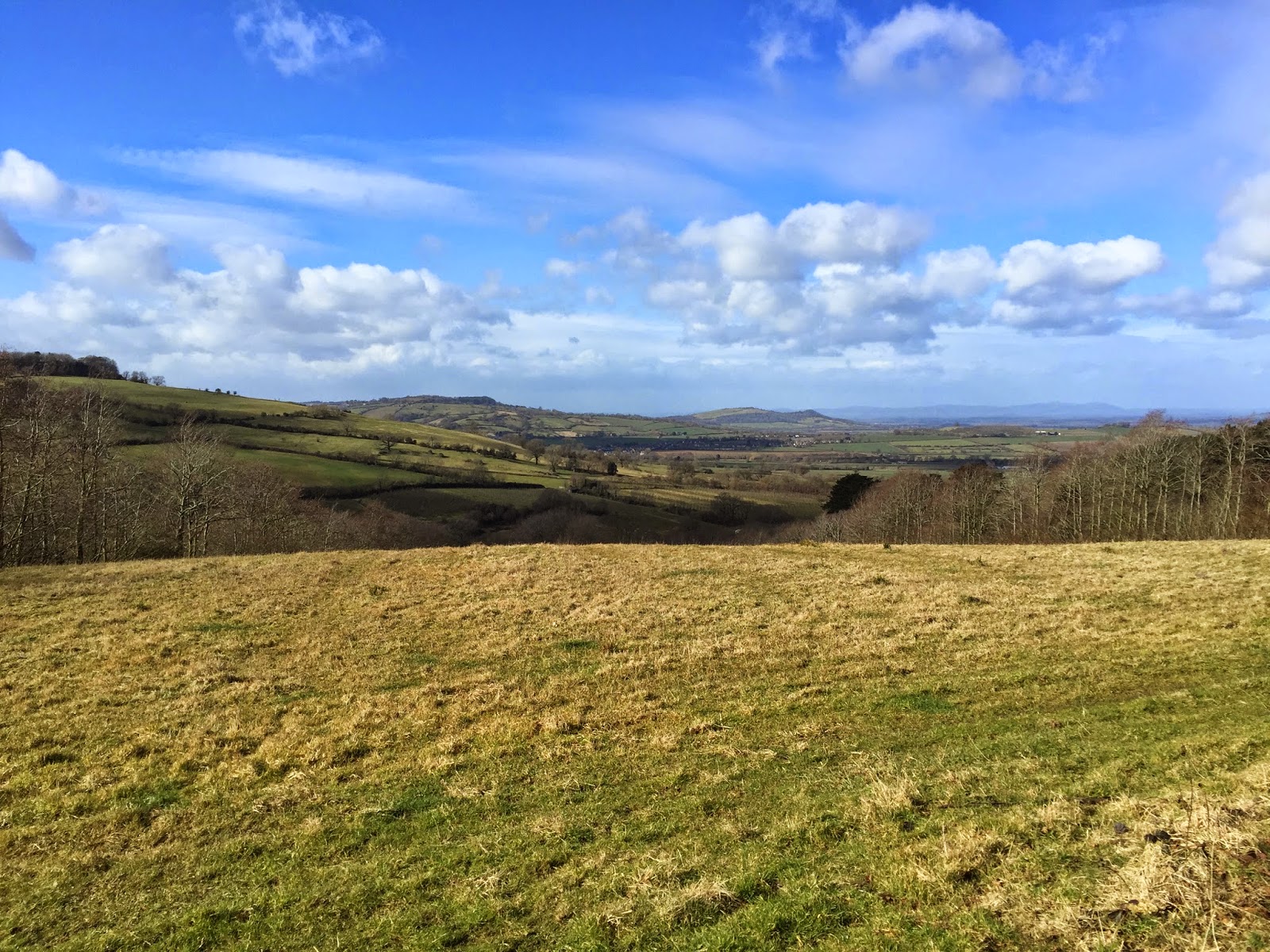
We were glad that the forecast seemed correct on the morning, and we set off with high hopes for a good walk in an area we know is beautiful. It was surprisingly chilly once we stepped out of the car, and we were already captivated by the great view before us - and we hadn't even gotten our boots on yet!

The views were even greater once we were on the footpath, it was stunning how the landscape was lit by the early morning sunshine.

Fantastic views; Dumbleton Hill and Bredon Hill visible in the distance
There was also plenty of sheep to be seen right from the beginning, which signalled that we were in proper Cotswold country.

Sheep and the view behind them
There were some super cache placements, all of which were in sensible, purposeful locations. Also, the caches were all well-stocked, which is a rarity these days. For this reason, it felt like a real back to basics series.

The views continued; after walking around a farmyard and along a quiet lane for a few hundred metres, we turned right to battle a strong westerly wind. The views towards Cleeve Common, however, more than made up for it.

View towards Cleve Common 
The superb views and good caches continued right down into Winchcombe. We could see dark clouds in the distance, which we reckoned were two hours away, and we were only just nearing the half way point - we hoped that we could continue the walk in the lovely sunshine, which was enhancing our already breathtaking surroundings.

Just before entering Winchcombe, we saw some lambs, the first I've seen this year.

Lambs
Winchcombe itself was filled with muggles. There was a newly completed path which welcomed plenty of dog walkers and runners, so we had to be patient and stealthy at the locations for the caches along this stretch.

We then walked along a section of the Cotswold Way known as the Pilgrims Way, which was a historical causeway, with many of the residences named after monasterial terms.

We knew that having walked down the hill into Winchcombe, we'd have to go back up at some point. It was worth it, though, as we enjoyed even more views which were emerging all around us. It's always great to feel elevated on a walk, and that's exactly what we felt along this stretch.

Even more great views as the walk uphill begins

As we continued uphill, we spotted a familiar name in one of the logbooks: castleferrets - they must be out walking in the area as well... would we bump into them? Once at the top of the hill, some of the best views of the day could be enjoyed as the sun continued to shine.

The views remain, even better on top of the hill again
We were then nearly at the end of the series, with just a couple more caches to go and a Church Micro - if 'Church Micro Awards' existed, I think that this Farmcote one would easily win 'Best location'! We chuckled at the sign on the stile, and then crossed the ploughed field to the final cache of the series which was quickly found, a unique container in another good spot.

We bumped into castleferrets on the way back to the car. After a quick chat, we went our separate ways as they had another cache to do and we needed to head off to the Bonus, which was a large, well-stocked container and a fitting end to a fantastic series just as it began to drizzle.

I cannot fault this series; the landscape was beautiful, the views consistently superb and the caches were all well stocked and of high quality. There was also a wide variation in terrain, which always makes a walk all the more enjoyable. I definitely recommend this series, a simply stunning walk on a sunny Sunday morning.

So, I think that's it from me! Unfortunately, I won't be able to go caching until the end of May (although I may find the odd cache from time to time), so until then... happy caching!

Griff Grof

Tuesday, 17 February 2015

Great Cotswold Walk: Central loop

The Great Cotswold Walk, 132 caches, 23 miles, Quenington, Glos  

Hello!

It's been a few weeks, I know! We haven't had an internet connection for a fortnight and so I've only been able to update the blog today now that we have it back. I've set the date and time of this post to 17th Feb which is when I completed the Great Cotswold Walk.

Here's one final reminder of how we've split the walk before I begin my review of the Central loop:


GCW Central, 62 caches, 10 miles (1-37 and 71-93 + a couple of others) 

Once again, we had chosen a beautiful, sunny day to find more of the GCW caches. With the North and South loops having set standards so high, we had great expectations for this final section, and we were glad to get going early; in fact, the lanes we walked along at the beginning were extremely icy, and Fizz the geodog nearly slipped a few times (as did we!).

We were enjoying a walk through lovely open countryside to begin with. The caches were straight forward finds, and it was great to see some more snowdrops - we really can't wait for Spring!

Snowdrops - we've seen a few along the other GCW rings as well!

We were taken through some lovely little villages and hamlets, before the views really opened out. In fact, we feel that this loop had the best views out of the three, and they were made all the better under the sunshine. Unfortunately, we had to miss a cache out since farm workers were managing the hedge lines - hopefully the cache wasn't picked up amongst all those logs and twigs!

Views - even more beautiful when you're there! 
The time flew by as more caches were found. It was nice to walk through the lovely hamlet of Ablington again. We walked past an old tithe barn; can't remember the date it was built but it was sometime in the eighteenth century.

Old tithe barn in Ablington
A few caches later we were in in Bibury, a pretty Cotswold village which was filled with tourists - even today, a Tuesday, in February! I think it's neat how the route took you through Bibury as it's an iconic Cotswold village, so it just makes the series feel even more 'Cotswold'. We actually diverted slightly to find the cache in the heart of the village and to take some photos of the River Coln. We decided that there wasn't time to go to Arlington Row to see if the yellow car was still parked there!

The River Coln in Bibury 
The final stretch of the walk was fantastic, since we were walking alongside the Coln again, having done so on both the South and North loops. The river was just as beautiful today, idyllic, in fact.

Home stretch - the Coln one last time
All too soon, we were back in Quenington, where we had started the series just under a month ago. 26 miles and 133 caches later, we've completed possibly the best 'power trail' in the country. A very memorable series; whilst there aren't any elevated views, the route is beautiful in another way. The stretches along the river were wonderful, the settlements we passed through were lovely, and there was plenty of wildlife to be seen - overall, the area was mostly quiet and pretty much untouched.

The caches were all there to be found, which is just what you want with a series like this. We had five DNFs, but only where there were too many muggles to search or where the cache was clearly missing following DNFs before us.

To conclude: it really is a Great Cotswold Walk.

Griff Grof

Sunday, 1 February 2015

Great Cotswold Walk: North loop

The Great Cotswold Walk, 132 caches, 23 miles, Quenington, Glos 

We weren't sure if we would be able to go caching this weekend! We awoke to three inches of snow on Saturday morning, with the forecast promising more overnight. It's always surprisingly difficult to find caches in the snow, so we were hoping that that they were wrong... luckily, they were.

We decided to complete the Northern loop of the GCW today; here's a reminder of how we're splitting the series:


GCW North, 36 caches, 6.5 miles (38-70 + a couple of others) 

Once again, we were lucky to be setting off under some lovely winter sunshine; we parked in the beautiful village of Ablington for this section. 

The River Coln in Ablington
The paths to begin with were great, and they offered us some nice views over the Gloucestershire countryside. Once again, the caches were easy to find, which meant that we could build up a good pace.

After just a few caches there was an obstacle in our way: the path was blocked by what appeared to be a natural dam. We followed in the footsteps of the walkers ahead of us, and navigated across by turning right down the valley for a few hundred metres until there was no water in sight. This actually brought us closer to an existing cache, GCT492, and so we decided to go ahead and find it. A stunning spot, with fantastic views; you could almost picture the valley being carved by meltwater at the end of the ice age.


The valley on the way to GCT492

We then enjoyed a stroll through some wooded areas. Unfortunately, the sun disappeared around this point, but this our spirits certainly weren't dampened as a result. We even saw some snowdrops, so spring can't be too far away!

Snowdrops 

The only thing the Southern loop lacked, if anything, were views from an elevated position. We were glad that this stretch of the series offered that; although we weren't too high up, the open wold views at #58, in particular, were fantastic. In fact, it even started snowing at this point!

Nice views looking back
Before too long the clouds made way for the sun, as we embarked on the muddiest stretch of the walk, which was also home to the most wildlife. We spotted four hares, and a fox and deer were less than ten metres from us at one point! This also turned out to be the quietest part of the series, with not a single person in sight, so I guess you could say that walking through mud for two miles was worthwhile!

We arrived back in Ablington all too soon, marking the end of another superb part of the Great Cotswold Walk. We had a brilliant time yet again; the walk was fantastic with some great views and a variation in terrain. Some of the caches were great hides, yet they were all straight forward finds which is just what you want on a walk like this.

We can't wait to complete the final, larger Central loop, which has around 60 caches! However, we've noticed that a few of them seem to be missing, so we're not sure whether we'll hold fire until they're replaced, or just go ahead anyway...

To summarise the GCW so far: magnificent.

Griff Grof

Sunday, 18 January 2015

TWW - The Worcestershire Whopper

TWW - The Worcestershire Whopper (GC5DERW)

Today we found a brilliant cache. In fact, I think it's amongst the top caches we've ever done.

Let's start by saying that it's Whopper by name, and whopper by nature - it's at least four times bigger than the second largest cache I've found. Sure, this made it special, but there's also so much more to it; in order to obtain the coordinates for the first part of the final cache,  you first had to find two fantastic feeder caches.

In this blog post I'll be running through the whole journey and experience of finding TWW, without revealing any spoilers. Enjoy...

Feeder cache 1 found on 13th December: 
GC5AWQ0 - Ashton Circular 1 - ABFTN Dog & Bone
Part of a series of 8 caches, 2 miles, Ashton-Under-Hill

For the first feeder cache, we arrived in Ashton for a walk along the lower slopes of Bredon Hill. We had high hopes for the series since we remember the hill fondly from previous caching trips.

It was straight on to the feeder cache as it was the first, and its initial stage had us chuckling since I had looked straight at it ten minutes earlier - absolutely fantastic, and very ABFTN.

We enjoyed some pleasant views as we progressed with the Multi whilst bagging some more caches. We'd recommend visiting the location for GC5GNJX, since the views up there were particularly stunning.

Super views from GC5GNJX on Bredon Hill

Have to admit finding the second stage of the Multi a little difficult, but we soon got our heads around it following a quick PAF (thanks TJ!) - it all suddenly made sense. The twist that followed was ingenious too... I never thought a Multi which already had so many unique and creative stages could keep on getting better and better. The container at the end was a welcome surprise too, and we were overjoyed to have half of the coords for the elusive TWW already!

We also found some more creative caches as the series came to an end, with the Church Micro particularly standing out.

Lovely church in Ashton-Under-Hill

Overall, it was a very enjoyable series in a lovely part of Worcestershire, which we'd recommend to all. Plus, it ups your appetite for TWW following such a brilliant feeder cache!

Feeder cache 2 found on 14th December: 
GC5H8M1 - Mile Drive Multi
You pass 3 other caches

The very next day we popped out to grab the second and final feeder cache in order to have all TWW details at hand. It's a Multi, by Wrighty... need I say more? It was great!

The Mile Drive is a stretch of the Cotswold Way, and it's one I know quite well. Plus, I found some of my first caches along here, so it brought back some good memories as we returned.

Nice views along the Mile Drive (photo by walktall on Geocaching.com gallery, we didn't have our camera) 
This was a real back to basics cache - a straight-forward two stage Multi, in a lovely location with some nice views, and a large, well-stocked cache at the end. Quite frankly, this is what all caches should be like!

After we had rummaged through the cache, we jotted down the remaining numbers for TWW's location,  and we were over the moon to be ready to find it!

THE WORCESTERSHIRE WHOPPER found on 18th January 

A month came and went and we finally pencilled in a visit to the main attraction. It was a beautiful, sunny day, albeit a little chilly, and we arrived at the coords early in the morning. Popped in to say hello to H and L of L8HNB, with H kindly offering to visit the cache with us.

I was surprised how quickly I spotted the required info at the first stage, and then it was on to GZ, which was a nice spot. Surprisingly, I walked straight past the cache - it was very well camouflaged for its size!

As I mentioned at the start of the post, it really was gigantic - so large that I could have jumped inside it! Plus, there was plenty inside, and I'm sure that if I'm passing by I'll drop some more stuff in such as larger swaps and TBs, in fact, I may even take something out too.

Overall, a brilliant experience in lovely countryside - from finding the fantastic feeder caches by sumadartson and Wrighty, to opening one of the best caches I've ever found. A truly memorable find; this is what caching is all about.

Griff Grof

Sunday, 20 July 2014

Sugar Loaf and The Blorenge

Hello! I have been quiet for around a month on here as I've, literally, not been caching! HOWEVER, yesterday was 'CacheWalker On Tour: Sugar, anyone?' event day, and so walktall, tarmacjohn and I set off early to head out to Abergavenny, located in the East of the Brecon Beacons national park, Wales.  

There was one thing on each of our minds: the weather. For the past week, the forecast was assuring us that we'd see heavy rain from 10pm. We were overjoyed when they changed their minds, promising a generous dry spell between 10am and 2pm, with heavy rain and thundery showers thereafter. They changed their minds, AGAIN, and we awoke to a prediction of rain for every hour of the day. Fantastic when you're heading out to climb a mountain (or two, in our case, as we had decided that we'd head over to the Blorenge after the Sugar Loaf event). 

Nevertheless, the weather remained dry on our drive over, and as the car ascended up the lower reaches of Sugar Loaf we were welcomed by jaw-dropping views behind us. However, as we parked the car and met up with other event attendees, we were disappointed to see that the view was fast being hidden by low cloud: and if we were having trouble seeing the views down here, would we be able to see anything at all 300m up on the summit?! 

It was a pleasant ascent up the mountain, in good company, and stories were shared as we approached  Sweet Spot and Mick's Stash, the two caches we'd planned to take in on this pre-event group walk. The landscape was lovely, the hillsides carpeted in fern, and we were now well above the tree-line, and approaching the summit. Sadly, though, we could not see further than 15m, thanks to the low cloud. It was great having Funk to Funky with us, as he's part of the local mountain rescue team, and so he could share some of his local knowledge with us! 

And after a last push upwards, we had done it: summited Sugar Loaf, at noon, marking the start of the official event! For about half an hour we had the whole summit to ourselves, which we admitted was a rarity. Details for the YOSM and Earthcache were jotted down, before a picnic lunch was enjoyed - whilst we couldn't see far, to our surprise it was STILL dry, against all odds! Therefore, we were having a good time anyway, as we continued to geo-chat.


Is that a view emerging from the low cloud?!
It was nice to see the clouds clearing a bit just as we were about to descend, which meant we could catch a glimpse of the fantastic view we'd seen in previous photographs! As we approached the car park on return, the cloud had lifted even more and the views were amazing - such a shame we couldn't take them in from the top.

View from Sugar Loaf car park; cloud now lifted - imagine them 300m further up!
From the parking, we continued to admire the views! We then bid farewell to our companions. In my opinion, it was a great event, and we were extremely lucky not to get soaked whatsoever! We found some quality caches in nice spots, and we did enjoy the glimpse of the views on the way back - admittedly, it was a shame we weren't met by sun today, but I feel that this didn't dampen our CacheWalker spirit. I wonder which mountain we'll tackle next?! Well, for myself, TJ and WT, the answer was looking straight at us...
That's where we're heading: The Blorenge from Sugar Loaf car park.
Off to the Blorenge - almost certainly to get wet! Whilst the forecast at one point had hinted the dry spell we had experienced, rain was always promised thereafter. However, we just had to grab a couple of special caches, so we decided to head over anyway! 

First, it was The Punchbowl Earthcache; a valley formed by a glacier, with a small lake left over from melt water, presumably. I won't go into Geological detail here - otherwise I'd be giving you the answers. It was an idyllic, peaceful spot though, and some locals turned up to go swimming just as we were leaving - brave souls!


The Punchbowl
One Blorenge gem down, another to go, and still no rain. TJ had noted that there was a lightening storm heading over from the East, but we were glad when twenty minutes later we found out it was actually heading North. From where we had parked, it was a very steep climb up The Blorenge. By now the cloud was really lifting, and there were some stunning views on our way up, lit by the sun which was trying to break through the higher clouds. Our target was The First in Wales, a cache placed in February 2001, just below the summit.

There were boulders everywhere - which one was it under? WT thought he spotted something, and I went to check it out - there was the cache (a large ammo can), filled with swag and TBs all these years later. This is now my oldest cache find, and what a location.

It's sad to think that you don't see caches like this one published these days. Gone are the treasure-troves at the end of a great adventure. It was a pleasure finding this cache whilst they still remain.
The First in Wales: nicer caches placed back then! 

To round off the day, we continued on to the summit to enjoy the far-reaching views and log the YOSM. There was even some sunshine, now! An absolutely brilliant spot to reflect on what has been a fantastic day, summiting two mountains, in good company, whilst picking up some superb caches. The Blorenge wins for me, but perhaps that's because we got to enjoy the views this time. Will have to return to Sugar Loaf soon, as they're meant to be even better over there! Really cannot believe we didn't get wet one bit, and were left wishing we had brought our sunglasses! Next time, don't listen to the weather forecast!
Sunshine?! Absolutely stunning views from The Blorenge summit! 
Griff Grof.


Saturday, 20 April 2013

Some Devonshire caching

West Alvington Stroll, 4 miles, 15 caches. First cache: GC3BPWZ

Down in Devon for the weekend for family matters, and we planned to sneakily squeeze in a local series of caches to complete early Saturday morning.

We chose the West Alvington Stroll, taking off from Kingsbridge. As my dad knows the area especially well, he suggested this walk would be a cracker; I could certainly tell so by some of the contour lines on the OS map! In addition, it was (by far) the sunniest day of the year so far, therefore I was especially hyped as we parked at the village hall and set off, as a whole family, on this loop!

We were greeted by a friendly cat, and we wondered if s/he'd ever part our sides as she followed us long past #1, but eventually parted ways with us (never actually noticed when s/he vanished!)

There were serval sneaky hides as we continued along the route. But I almost forgot about caching as I got lost in the amazing views; this really is a lovely corner of the country. Living in the Midlands, there's also some overwhelming feeling every time you see the sea, and this was certainly the case on this walk, parts of which circled Collapit creek.

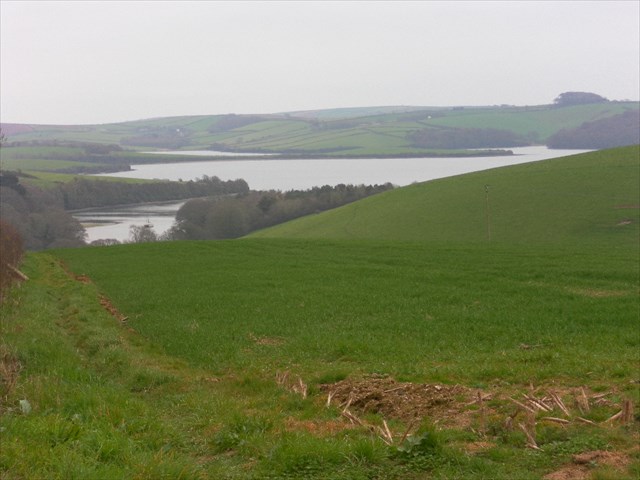
My favourite part of the walk was the descent down towards the estuary. The views were best here, panoramic and captivating:

Image taken from Cache Gallery, Geocaching.com, uploaded by user on 01/04/12. Unfortunately, I was too busy enjoying the views, and forgot to take out the camera! Obviously it was far sunnier when we did the series, and the views I describe were even better further up!

We soon faced a challenge: we had been teased with the same cattle field being in our sight the whole way, and now we had to cross it. For those of you who don't know, we dislike cows. Never have before. If you want to know why we do now, find my blog post from 27th October 2010 on here! - let's just put it this way: we were chased by a herd of them in to a river. I had never been directly through a cattle field since. But now we had no choice. This is getting a bit dramatic, right? Well, luckily they caused us no problem, and we were rewarded with more good views at the top of the hill, but, sadly, not with the cache. We knew it was a challenging one, but we simply couldn't spot it.

So on we continued, crossing Collapit Creek, idyllic under the shining sun, taking in even more views (now across the valley over to Kingsbridge) on the homeward stretch; a nice, sneaky hide to finish things off. 

In conclusion, a throughly enjoyable series: good range in cache containers, superb views all the way round and a good mix of terrain. Highly recommended. 

~

Before the day was out, we joined the wider family for a pub dinner on the shores of Slapton Sands as the sun set. Quickly popped out to grab the adjacent Earthcache, which I really enjoyed, being a Geography enthusiast! 

I'll have to make sure next time we're down here to squeeze in some more caching, as we had a great time this time round!

Griff Grof

Friday, 4 January 2013

New Years day on Fan y big and Cribyn

Hello,

A couple of days have gone by, but this is my account on my New Years Day trip to the Brecon Beacons with caching friend tarmacjohn and my dad. A fine way to start a year, and we picked up two super caches on the way, on two high peaks - Fan y big, and then Cribyn. We battled the bitter winds, and the steep terrain for these, and due to time had to leave Corn Du and Pen y fan for another day.

We set off in the dark from Worcestershire, and were welcomed into the Welsh mountains by a bitter cold wind- and we were only just in the car park!

It was a two mile walk to the first cache at the first peak, BBC7 The Diving Board, and to get there we were walking along a relatively flat track, but it was by no means easy terrain! It was rocky wet, and we even had to cross a river at one point!


It was a steep climb up Fan y Big, and at the top there was even snow - the wind chill must have dropped the temperature to -10!  At the diving board we each had a photo taken, whilst working out the caches final location. It was then off to GZ, where we found the cache in its resting place. A super find and one of my all time caching highlights!

Next it was off to Cribyn, the next peak, after deciding that it would be our last due to the freezing temperatures - we'd be back to climb the other two soon! There was an Earthcache near the summit of Cribyn too!

An even steeper climb up to this one, but the views were well worth it at the top! The Earthcache was easy enough, and actually answered a question about the landscape that I was pondering upon as I came up.

Overall a very, very good day and a great way to start 2013 - apologies for the short and snappy post, but I'm tight on time, and I didn't want to postpone writing this any longer - I may come back and edit it soon though!

Happy new year!

Griff Grof

Tuesday, 24 July 2012

Geolympix Mega 2012 and part of GMS series

On Sunday 22nd of July, 1000 Geocachers from all over the world came together in Oxford town hall, for the first ever Geolympix Mega, and the start of a summer festival of caching - after two years of waiting, the big day had come, and my moment to make my grand return to caching after my little break. It was fantastic!  I also had a go at the Marathon cache-a-thon series on Monday, the day after, so read even further for my review on that! 

22nd July - 11 cache types in 11 hours challenge, and attending the Mega

As the Geolympix is all about breaking your own records, and being "Outstanding in the field", the challenge set by the team of finding 11 different cache types in 11 hours really stood out to me. This would involve the day being even longer, but I knew it would all be worth it. I had been looking at the map for weeks, trying to work out which caches I would choose - I needed an Earthcache, Traditional, Multi, Puzzle, Wherigo, Virtual, Webcam, Letterbox, plus an event, CITO event and the Mega itself to get the 11 - all to be found within just 11 hours!


Event Icon. 10 to go. Found @ 08:00:
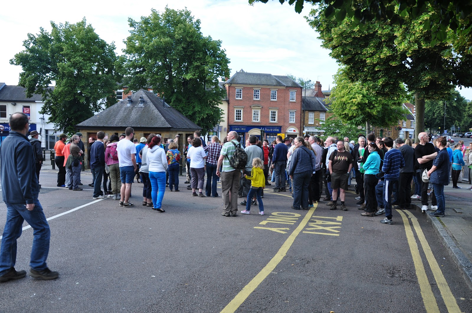
The Geolympix team had organised a flash mob event (1 icon down) in Banbury, at front of Banbury Cross Webcam, starting at 08:00, with the group Webcam shot at 08:15. When we arrived, we were shocked to see nearly 200 cachers all gathered at GZ - we knew we wouldn't be the only ones having a go at 11 in 11!! Saw some friends from back home, and ones I've met at previous events, and had a good catch up, before queuing for the log book, and gathering for....


Webcam Icon. 9 to go. Found @ 08:15
Once the event was coming to a close, Simply Paul, one of the Geolympix organisers, rounded us all up into a group, so we'd be in view of Banbury Cross Webcam. He snapped the photo, and with two icons already done in just fifteen minutes, it was off to do the rest...

Traditional Icon. 8 to go. Found @ 09:05 
From Banbury, we went onto the M40, for a 30 minute drive down the motorway until our stop at J6. Here, we parked in a parking area for several trails, and I went down a little path to bag another icon, fairly easily - there wasn't anywhere else it could be!

Multi Icon. 7 to go. Found @ 10:12 
As we walked back up from the traditional, we bumped into walktall and his friend Lone Hunter, who were just arriving. As we're friends from back home, we knew each other well, and we all decided to set off together to bag the rest of the icons in the area. We programmed in the nearby Wherigo, and while it was running, we set off on the start of a long circular walk of around 7 miles in the area, and the first cache we passed was a Multi, so it was a quick solve of the puzzle before finding the cache. Still no sign of where the Wherigo was leading us!

Earthcache Icon. 6 to go. Found @ 10:52
On from the Multi, and a bit of walking along the roads, walktall and Lone Hunter lead us to an Earthcache, which wasn't the one we were initially planning (but we did all find that one on the way back to the car too) but it was still the coveted icon that we needed. You had to examine the cutting of stone eitherside side of the  M40, from the footbridge crossing it! I was a little concerned about dropping something, possibly the highest footbridge I'd been on, and one of the busiest motorways! I learnt a lot about the cutting though, from my dad walktall and Lone Hunter, so it was all made worthwhile!


Wherigo Icon. 5 to go. Found @ 12:17 
There was still no sign of the Wherigo, in all that time, and we had reached the bottom of a steep hill when the cartridge read "Up 2". It was sending us back up the hill we came down. So, it was up again where it then read "Down 1". Then when we arrived "Down 2". A little later "Down 3". It had led us in a big circle, the irrating part was having to go up some of the paths we had already walked down! However, the area is truly stunning, views were to die for, lots of flora and wildlife to be seen, so we all enjoyed the route - it was beautiful, one of the most lovely parts of the Chiltern Hills I'd been in. Once at the bottom, the cache was finally found very near to another Earthcache (which we then logged) and the icon was finally seen. It took us a while, but thankfully we found it (after starting the cartridge first thing) without any further problems, and enjoyed the route it took us on very much.

Letterbox Hybrid Icon. 4 to go. Found @ 13:51
Once we had bid farewell to walktall and Lone Hunter (thank you both for your pleasant company, which my dad and I both highly enjoyed) we drove a few miles south to Northend, to bag the last icon we needed in this area, and before setting off to Oxford to attend the main Mega event. It was a nice walk through some rich meadows and into the woodland at the top of the hill; we were really in the heart of the Chiltern Hills. The cache was a very quick find, in the only place it could be, and I was over the moon that we had already done seven icons, and there was only four to go!

Mega Event Icon. 3 to go. Found @ 15:01 
The big moment had come. Once we walked into the town hall, and registered, we had another icon bagged, and though most people had left, we still saw even more familiar faces from home, and I had a good time walking around the various stands and purchasing some items. A little sad actually on how empty the place was, but it was still very enjoyable, and I got to meet and thank Simply Paul for all his hard work. My second Mega, and what a superb one it was! Excellent!

Unknown Icon. 2 to go. Found @ 15:12
While I was looking at the GAGB stand, I found the Cuckoo cache, a rare moving cache, and I logged it to claim the icon - that one was easy! Was good to find it at last, and knew I was saving finding it for some reason!

Virtual Icon. Just 1 to go! Found @ 16:38
We left Oxford Town Hall, and the main Mega event, for a walk around Oxford, taking in the lovely sights, and we bagged a Virtual along the way, meaning we only had the CITO event a little later to complete the 11 icon challenge. A very interesting virtual, and after finding it we went onto another, before setting off to have something to eat as we waited for the CITO event to start.

CITO event Icon. Challenge complete!! Found @ 18:43
And that was it! Arrived at the CITO start point, and signed the logbook, meaning we had completed the 11 icon challenge!! But we also saw walktall again, who had done 14 (adding on some types from another listing site) and later on CacheWalker confirmed that he had managed to find all 7 cache sizes too! So a special well done to walktall! But I was happy enough with our 11, and spent the next 30 minutes giving something back, and picking up litter all over the place, before I found a 5/3.5 cache, of which I had to hang off a bridge over a canal! Great fun, and a good way to finish the day (Glad to say I wasn't passed the logbook to sign, I retrieved the cache the hard way myself for a fair and honest find!)


So, that was that! The Mega event attended, the 11 icons in 11 hours challenge completed (with time to spare!) One of the best caching days I've had, and congratulations to Simply Paul and the rest of the committee for a very successful event!!

23rd July - Geolympix Marathon cache-a-thon (GMS) Rings B, A and E 
GMS Series, up to 26.2 miles, Turville, Buckinghamshire 

The next day, we were off to M40 J6 again, but this time to the village of Turville - the main filming location used for "The Vicar of  Dibley" and various other famous films and television shows. The GMS series is set over five rings, A,B,C,D and E,  totaling in around 110 caches. You cross the place you are parked at the end of each ring, so opportunity to stop at any time after any ring. We set off with flyhiy, initially planning to do all five rings, but with B as our starter, we realised how wonderful, beautiful and tranquil the area was, and so we decided not to rush it for numbers, and to take our time to enjoy it, doing as much as we can, and not pushing it with the excessive heat.

B was the first ring we decided to do. And it ended up being my favorite. Started at 06:45, and the sun was just rising, making the dew sparkle beneath us. The hill on our left had a windmill on top, the very one used in "Chitty Chitty Bang Bang", which was now the only building in sight. We then tackled the first of many big hills. As we rose up the Chiltern Hills, we became surrounded by the most magnificent woodland, and the views from it were amazing.


All the caches were easy finds on B, A and E, with sensible hints , and one thing I liked about the series was the fact that they weren't too close together, so you could enjoy the walk at the same time. 


As I said, on B there was plenty of flora, and lots of orchids - we also saw several red kites - amazing! 


One of the things that made ring B my favorite of the three we did, was the fact that it had such a wide variation in terrain - though most of it was woodland on the hill tops, you descended into open grassland valleys, walked through farmland (several herds of cattle, but they were all too lazy to move under the now scorching sun), but yet there was always some sort of view. And, with the caches being so easy, we could move on quickly and not feel let down by any DNFs. 


As Ring B only consisted of 17 caches, we managed to walk pack to the village finding C18, C19 and C20, totaling in 5 miles so far. The marathon was going great so far, and at the car we stopped to enjoy some cold drinks (though the pub was still closed!) and then we set of for A, which promised to be good, having accumulated the most fave points out of all the rings. 

Ring A was the longest, 6 miles, but we were doing well for time. By now, the heat was unbearable, so we had sun cream and sun hats on! Again, a lovely uphill start, which was proving to be a trend, and then into further woodland to cool us down. One of the things I loved about the day was the fact that there were so many cachers out and about, met Dobunnies on this ring, but whenever we got back to the car, we could see other cars with TB stickers on them - it was just great knowing that these rings have brought so many people from all over the world (saw several people from Norway and USA) to this stunning area. It was good to know that we were almost sharing the fun with them. 


By the time we had finished A, we were starting to feel a little bit tired, only having walked 11 miles throughout the day, but the 30c temperatures were really slowing us down and adding to the tiredness, we arrived in the pub and I enjoyed a cold lemonade. There was two hours to go to the BBQ at "Geolympix 2012 Post-marathon Meet", so flyhiy and I decided to push on to complete one more ring, while my dad stayed in the shade of the pub garden waiting for the event, and chatting to other cachers who had already given in under the heat. 

We set off to do Ring E. We wanted to do D, passing the windmill, but E was the shortest, and therefore most logical as we had to be back in time for the BBQ in two hours. E was just as nice, again going through some more woodland, and it was here that I was certain this is one of my favorite series' overall - just a shame we couldn't do D and C - but it is another reason to come back! While on E, flyhiy and I met another cacher, and the three of us completed E, and we walked back to the pub. 


The GMS series was, well, fantastic! One of the best I've done! As I said, not doing C and D is good in a way, because we didn't rush it (got to enjoy the walk more) and it's a good reason to come back to this stunning area! Highly recommend this series, B was the best out of the three of five we did today, but several other cachers at the BBQ event said D was their personal favorite. But who knows, maybe I'll change my mind when I've done all of the rings? All in all a great area, and up there in the top three days of caching that I've ever done - along with the Geolympix Mega 11 in 11 the day before! 

The BBQ was also the perfect way to end the day, thank you to the Geolympix team for making the Sunday possible with the Mega, and for the brilliant marathon cache-a-thon; lots of work went into it all, which you can clearly see! That's it for now folks, and I might (not 100% sure) be attending the Geolympix closing ceremony on Coombe Hill, if not that ends the Geolympix story for me, if so I might see you there! 

Griff Grof